
Learn The Bible Through Maps
Introductory Study Package With Improved 2022 Regional Study Guide
The Introductory Study Package includes:
• Regions on the Run book
• Regional Study Maps full set of 7 maps
• Regional Study Guide for map marking

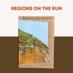
Regions on the Run treats each arena separately and illustrates them by short essays called Field Trips Through History. Biblical events in the ‘Field Trips’ illuminate the dynamic of each arena, and each ‘Field Trip’ is carefully linked to an easy to use interpretive time-line (chart) that leads the reader through 4000 years of history.
pp 6-7
The land of the Bible is a ‘Land Between’—between the powerful physical forces of sea and desert and wet and dry, and the powerful centers of Egypt and Aram (northwestern Mesopotamia).
pp 8-9
The land’s story is overshadowed by Imperial Highways linking Egypt and Aram.
pp 10-15
The land’s well-watered and heavily traveled Northern Arena has major battlefields surrounded by Phoenicia, Damascus and the northern kingdom of Israel.
pp 16-21
The land’s arid and more difficult Southern Arena hosts major trade routes disputed by Edom, the land of the Philistines and the southern kingdom of Judah.
pp 22-29
The land’s strategic Central Arena is the battlefield of the Central Hill Country and Jerusalem. Gateways in and out of this arena make it the focal point of biblical history.
pp 30-40
This section contains a background discussion for reading the four Gospels, linked to a six-page Regional Outline of the Gospels and the large, fold-out 4000 Year Overview chart.
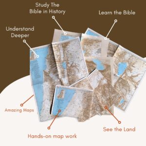
The Regional Study Maps are seven large format, 3-D maps of the land in color with actual relief, regional/site names, roads, elevations, other features on each map. The maps are 17x22 inch or 43x56 cm in size.
Context Maps
1. Middle East Map
2. Land Between Map
Arena Maps
3. Northern & Central Arena Map
4. Southern & Central Arena Map
Detail Maps
5. Galilee & Jezreel Valley Map
6. Heartland of Judah Map
7. Land of Benjamin Map
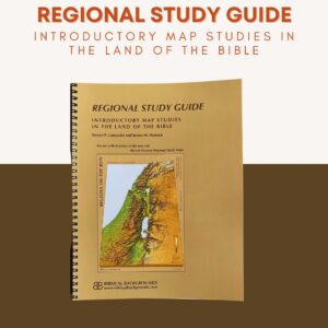
The Regional Study Guide is improved and updated as of 2022 and is included in this package in printed format only.
It offers discussion of twenty-four major events in the land of the Bible is presented on the seven maps listed above. The marking instructions on these maps create an interactive learning experience. The Regional Study Guide brings to life the above materials and leads the student in a personal exploration of the maps and charts. Frequent use is made of the large, fold-out 4000 Year Overview chart in the back of Regions on the Run. The temporal context of the biblical period emerges without the need to memorize historical facts.